Earlier this week we headed over to LaConner to have our electronics upgraded. Here's what we got: Garmin 7616xsv chart plotter, GHP Reactor autopilot with GHC20 control, GXM52 Sirius XM weather receiver, GMI20 marine instrument, Garmin gWind wind and weather sensor, and downview/sideview CHIRP sonar transducers, GST43 speed/temperature transducer.
Out with the old:
Hauling out for a couple hours to install the transducers (much different than our haulout in Juneau):
It's always fun to see the boat out of the water. The hull looked great…we did a quick pressure wash ("we" meaning the guy who hauled us out) and replaced one zinc…the one on the bow thruster.
Downview/sideview transducer on the starboard side:
Water speed, temperature, and depth sensor:
It was great…they hauled and hung us at the end of the day (a very windy day when most haulouts had cancelled) and we were able to get back in the water last thing so we didn't have to stay the night in a hotel.
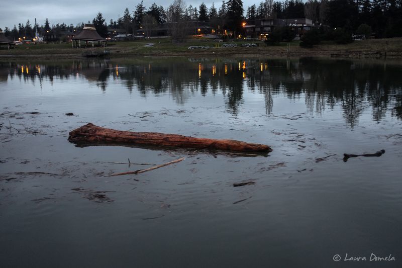
Yesterday afternoon we took the boat out for some sea trials to set up the new equipment and test that everything was working as it should. It had been so stormy previously that there was a ton of wood in the water, so it made it a bit tougher, but we managed.
Back into LaConner at dusk:
Look at all those logs ahead!
Everything checked out well and we're super happy with the new stuff!
Random daffodil field on the way to Best Buy the other day (blurry, taken not with my fast camera/lens):
This morning I took Airship back over to Cap Sante while Kevin drove over in the truck. It was definitely not as windy as the other day (and I had almost a 2 knot current helping me along, woohoo!) Hey! Look at those shiny new electronics!
Once back in Cap Sante we mounted the iPad holder and iPad. We run Navionics on the iPad for some redundant chart plotting.
Looks great there, doesn't it?
Our new wind/weather instrument mounted on the mast:
And while I'm up there, here's another shot of those huge new solar panels:
This afternoon was windy and rainy, but late in the day the sun poked through and the light was beautiful against the gray sky:
This new gear will give us a lot of capabilities that we didn't have before. The satellite weather will let us get marine forecasts, precipitation, wind and wave heights ANYWHERE, which will be super useful as we make our way up to Alaska again this spring/summer. The new wind and weather and speed sensors give us a lot of information about conditions where we are: what the winds and currents are actually doing, etc. The new autopilot will steer a much smoother course with less wear and tear on the hydraulic pumps. The new sonar will give us much more information (with way cooler images of the bottom — we'll show you some images once we have some). The 16 inch touchscreen is a LOT nicer and easier to use than our previous 12 inch non touchscreen monitor was (pinch and zoom! pinch and zoom!!) We can connect to the new system with our smart phones via Wi-Fi (and even mirror and control the display via iPhone). And…it all just looks more modern and cool. 🙂
Fun stuff! Now to go try it all out some more!


Cool. I was there on the same buoy about three weeks ago while moving my boat from Blaine to Bellingham. Your photos show almost exactly the same conditions we experienced. I did buy and read “The Light On The Island”. Buy it, it’s a good read and next trip to Active Cove you’ll have a different perspective. It’s one of my favorite anchorages.
Patos is one of our favorite too. Bought the book and it’ll be waiting for us at home. Thanks for the nudge!
This is such a great post! Beauty, mystery, returning to a place you love, and new information, too!
This is Teela, btw. No idea why Discus is pulling a super old username. 🙂
Thanks, Teela. 🙂
Just when you thought you were finally alone! They probably put their boat into that tiny cove on the east side by Toe Point. Or?…….
But are there any trails from Toe Point that would get you to the lighthouse? Some of that brush in the middle of the island is thick thick thick. They didn’t look THAT tough. 🙂
Trail Map link from state
http://parks.state.wa.us/DocumentCenter/Home/View/4916
Yeah, see? That whole half of the island is trailless! Where did they come from??? 🙂
Low tide made walking the shoreline feasible? C’mon, they didn’t just materialize there! Shoot, I need to sail up there right away and put an end to this theorizing!
Great story and pics Laura. We spent a couple nights there just before you did and the island certainly is beautiful this time of year — you captured it well.
Thanks Andy! 🙂